1.APRS Mission (refer to annex1) MOMOJI provides amateurs all over world with APRS service.
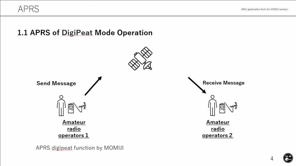
1.1Satellite station digipeater demonstration
Armatures send APRS message to MOMIJI. MOMIJI digipeat the APRS message to ground. Another Armatures is able to receive the APRS message.
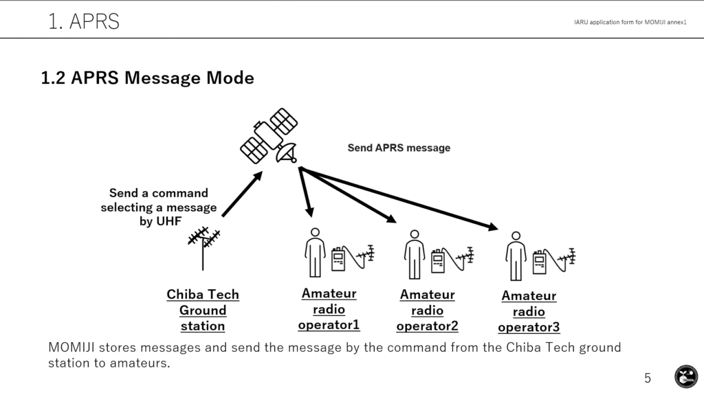
1.2 APRS message mode
Chiba Institute of Technology (here after Chiba Tech or CIT) send a command to select an APRS message from the APRS message list in the MOMIJI.
MOMOJI send the APRS message to the armatures.
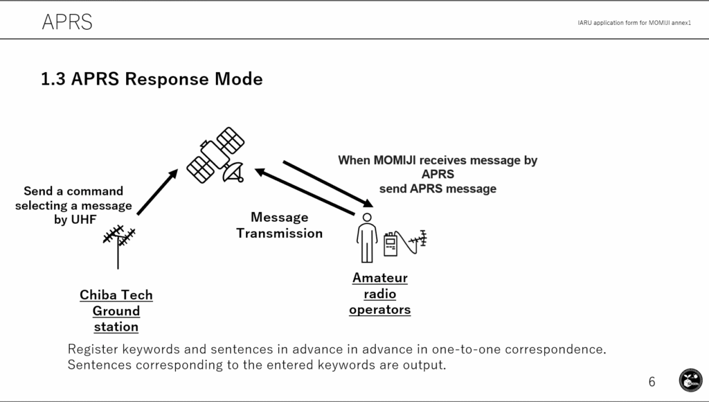
1.3 APRS response mode
Chiba Tech sends a command to select an APRS message from the APRS message list in the MOMIJI.
MOMOJI send the APRS message to the armatures when MOMIJI receives the APRS message from amateurs.
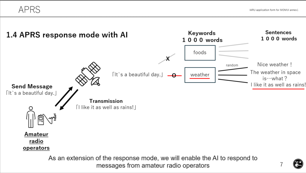
1.4 APRS response with AI
MOMOJI sends the APRS message generated by AI onboard MOMOJI to the armatures when MOMIJI receives the APRS message from amateurs.
All received messages are stored in the satellite and downlinked to. The location information will be shared on a map a website.
2.Camera Mission
MOMIJI is equipped with four cameras. The angle of view and resolution of each lens are as follows
1) (H) 62.2° (V) 48.8°, 3280 × 2464 pixels
2) (H) 66° (V) 41°, 4608 × 2592 pixels
3) (H) 62.2° (V) 48.8°, 3280 × 2464 pixels
4) (H) 68° (V) 83°, 3280 × 2464 pixels
The satellite will downlink the photos taken by the camera and recover them at the ground station.
The camera will take pictures of a specific area with magnetic field attitude control. Specific areas such as North Japan region and Mt. Himalayas will be calculated from satellite orbit and photographed.
The captured image data will be stored in the flash memory onboard the satellite. The image data will be segmented and transmitted via UHF downlink to a ground station, where it will be received and restored. The downlinked images are published on a website. The amateurs is able to download the images.